
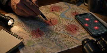


- Gather information about the quarry. A tracker must determine the quarry’s next move to get ahead of them and this is tough to do without first understanding who they are.
- Start tracking from the last place the quarry was seen.
- Try using a tracking stick. They are simple to construct and once you know the stride of your quarry, they are effective in locating the next sign, especially when tracking someone who is lost and not employing counter-tracking techniques to throw you off their trail.
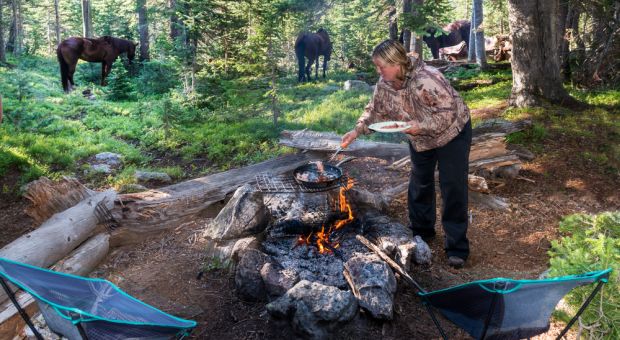
- For SAR (Search & Rescue) tracking, use a whistle as you track. You want the quarry to know you’re in the area and to signal you if they are able.
Tracking a person who is lost but wants to be found ought to be easier than tracking someone who is going out of their way to not be found. Unfortunately, this is not always the case because the folks who most often need finding are very young, suffering from dementia, mentally challenged or simply not functioning at 100% suffering due to fear, panic, injury, exposure, dehydration, malnutrition of some combination thereof.
Gather information
Obtain topo maps of the area. Answer the following questions as completely as possible:
- Who is the quarry or quarry party? Obtain photos if possible and distribute copies to the search and tracking parties.
- What is their age, physical condition and level of orienteering and outdoor survival experience? A small child will typically behave very differently from an adult with a lot of experience.
- What were they wearing?
- When and where they were last seen?
- How fast could they move?
- Do they have any known injuries or medical conditions?
- How were they equipped?
- What was their planned route?
If the quarry party has any outdoor experience, they may leave a trip plan with a responsible party and on the dash of the vehicle, but don’t count on it. If they did, it may contain the answers to the questions in this section along with sheets of aluminum foil that they will have stepped on, leaving clear impressions of their footwear. Even though this is recommended, it is rare that people do it. Perhaps it is rare that the type of person who leaves a trip plan gets lost. If you find the vehicle and see an envelope or packet, gain access to the vehicle to see if it contains a trip plan. Using the map, define primary and secondary search areas based on the time elapsed since they were last seen, route and estimated speed of travel.
Sign cutting
Because a certain type of person is fascinated with cool-sounding vocabulary, the term “sign cutting” is now nearly interchangeable with “tracking.” What cutting sign used to mean, was what a tracker does to initially find a track or to find it again after losing it.
The US Border Patrol uses dirt roads to cut sign along our nation’s southern border. The lack of rain and fine dust along the border make for a great tracking medium, so agents use chains to drag tires behind trucks to smooth or rake the road surface. When illegal immigrants cross the border and head North, their tracks are easy to spot where they cross dirt roads or the dirt medians of paved roads. Sign cutting along roads using vehicles enables border patrol agents to cover a lot of ground very quickly and effectively.
If you do not have conclusive sign to start from, note roads, trails and other lines of drift that might be useful for sign cutting. The quarry’s vehicle, camp or the last place they were seen are the best place to begin sign cutting.
Use all your senses
Stay alert and don’t fixate on visual ground sign. You might miss a trail sign, blaze or note. By smelling a campfire, spotting a signal or hearing a whistle, you may be able to cut the search short.
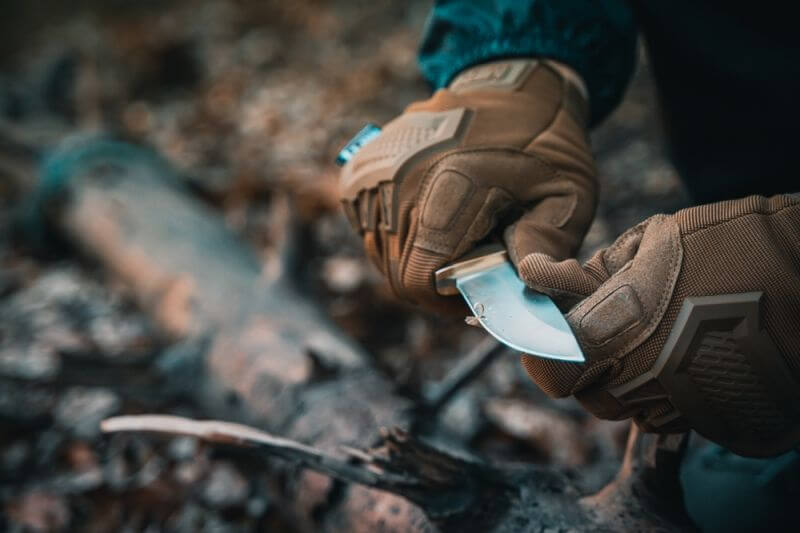
If new to tracking, try a tracking stick
A tracking stick is an aid to find the next track. Any hiking staff or trekking pole will do. Once you have encountered the track and are able to determine the quarry’s stride, set two rubber bands to the length of the quarry’s stride. The tracking stick can then be laid along the direction of travel to determine approximately where they next sign should be.
Look for notes, blazes & trail signs
If the quarry has outdoor experience, once they become injured or realize they are lost, they may stay put and create signals or begin leaving notes, trail signs or blazes. Blazes are made by remove a bit of bark from a tree in forests. They may also flag trees with brightly colored flagging tape or with retro-reflective tape that will reflect light back brightly at night and uses bright colors for visibility by day. In forested terrain, they may also make trail signs by breaking twigs or saplings in the direction of travel or by lining up sticks on the ground to make arrow shapes to indicate the direction of travel. In forest meadows, trail signs are made by tying tufts of grass and in rocky terrain, trail signs are created by piling rocks in kairns.
Tracking in forested terrain
The biodiversity of forests impacts the terrain and together, the terrain and the life in it create numerous clues for trackers who know what to look for. Trees, their fallen leaves, needles and sticks, undergrowth, spider webs, streams, mud, sand, moss growing on rocks, trees and the forest floor, all of it gives trackers something to work with.
- Broken twigs are time and passage indicators. They are sharp and lightly colored when fresh and duller and become darker as they age. They dry as they age, become more brittle. As they age, they become more likely to snap than bend.
- Broken spiderwebs give both time and passage indicators and can even indicate the height of the quarry.
- Large logs across the path will show signs of disturbance such as mud, scuffs or disturbed bark.
- Wet leaves are darker when disturbed. Dry ones are darker on the underside and lighter on top, so they show evidence of passage when disrupted.
- Fresh pine twigs smell of resin when broken and retain this smell for only a few hours. Longer than that and it goes away.
- The transition zones between forest and meadows receive more sunlight closer to the ground due the absence of canopy or only partial shade. This results in underbrush that will be disturbed by the passage of people or large animals.
- As the quarry passes through brush, he will drag it with him, indicating direction of travel.
- When crossing streams, water may be cloudier or darker where the quarry enters and exits.
- Moss indicates time of passage as it grows back after disturbed.
- If the quarry passes through underbrush or grass, he will leave a trail that is a slightly lighter or darker color than the undisturbed area. This is because the leaves are different colors on the tops and bottoms and slowly orient themselves to sunlight while still attached to living plants. The passage of quarry disturbs this and is visible at a distance as slight variance in color.
- In the forested terrain, the ground under stands of trees is usually littered with sticks and twigs. When a person or animal steps on a twig, they indicate their direction of travel. If I step on the middle of a twig that lays perpendicular to my direction of travel, the twig will break as my body weight bears down on it. This usually breaks the twig into three pieces because my boot pushes the center section of the twig down into the forest floor, causing two breaks, one at each edge of my boot sole. Whereas the center piece will be carried forward with the sole of my boot, indicating the direction of travel.
Signal using whistles
You don’t want to pass right by the quarry without you hearing or seeing them or them hearing or seeing you and if they’ve built a survival shelter to block the wind and keep warm, they provide great camouflage, much like a hunting blind. Whistles are a great way to let someone know that you are in the area without losing your voice.
- One three-second blast on a whistle means, “Where are you?”. Give your whistle an occasional blast as you search. It also lets you know where other members of your party are if they get out of visual range for a moment.
- Two three-second blasts on a whistle is a response to one blast which means, “Come Here!”
- Three three-second blasts on a whistle means “Help!”
Tracking glossary and definitions
The following is a glossary of tracking terms useful in SAR (Search and Rescue) tracking.
Activity Indicator – Sign or spoor that provides evidence that a specific activity has taken place.
Aerial Indicator – American combat tracking terminology for sign above ankle height. See ‘Sign, Top Sign” for British terminology.
Aging – The combined effects of the passage of time; wind, blown sand or snow, precipitation, drying, freezing, falling or growing foliage, contamination litter and other effects.
Animal Indicator – Spoor that presents evidence of the quarry species.
Angle Technique – Counter-tracking technique.
Auditory Indicator – Sound evidence of the quarry such as voices, radio noise or animal calls.
Average Pace Method – A method of estimating the size of a quarry party.
Blood Indicator – Sign left in the form of sanguine fluid evidence.
Bodily Discharge Indicator – Evidence of the quarry in the form of material discharged from the body such as fecal matter, urine or tobacco spittle.
Box Method – A method of estimating the size of a quarry party.
Box Search – Search technique.
Casting – Lost track drill or method of re-acquiring a lost track.
Color Change – Differentiation in color noticeable between a track or sign and the surrounding environment.
Combat Tracking – The discipline of finding, analyzing, following, and interpreting the sign or spoor of quarry, typically as a military or paramilitary squad or unit.
Comparison Method – A method of estimating the size of a quarry party.
Contamination – When track is contaminated by wildlife, the tracking party or a third party. See ‘Sign, Third-party Sign.’
Counter-tracking – The discipline of eluding a tracker or tracking unit.
Cutting for Sign or Sign Cutting – Searching for sign to establish a starting point from which the quarry can be tracked.
Direct Count Method – A method of estimating the size of a quarry party.
Discard or Discardables – British term for ‘litter.’ See ‘Litter’ for American combat tracking term.
Disturbance – A disruption of the natural state of the surroundings caused by the movement of the quarry.
Dwell Time – How long the quarry appears to have spent at a particular location.
Exit/Entry Points – Door, windows, passages, portal or points where the quarry transitions from one surrounding to another.
Flattening – The descriptor for the pancake effect of pressure on an area when compared to the surrounding surface.
Foot Angle – Angular measurement from the midline of the foot to the line of travel.
Ground Indicator – American combat tracking term for marks or spoor left at ankle height or below. See ‘Sign, Ground Sign’ for the British term.
Indicator – see ‘activity indicator’
Incident Site – Location where a discernable event occurred that can be linked to the quarry.
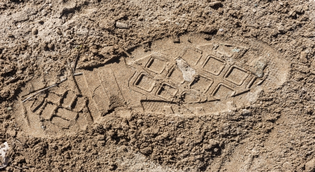
Key Print – Most conspicuous foot impression. See ‘Track, Key Track.’
Litter – American combat tracking term for objects discarded by the quarry. See British tracking term ‘discardables.’
Pace Tracking – Tracking the quarry move for move or ‘pace for pace’ to determine likely future movements or locations to search for footfalls or sign.
Pointers – Sign that indicates the direction of movement.
Quarry or Quarry Party – The animal, individual or party being pursued by the tracking party.
Regularity – The descriptor for the characteristically geometric and manmade sign left by manufactured soles and treads.
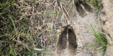
Sign – Evidence of passage or other activity
- Conclusive Sign – Marks or spoor give that provide decisive indication of the quarry.
- Inconclusive Sign – Marks or spoor that do not provide decisive indication of the quarry.
- Invented Sign – Marks or spoor that a tracker convinces himself are related to the quarry when it in fact is not.
- Ground Sign – Marks or spoor left at ankle height or below.
- Key Sign – The most conspicuous mark or spoor.
- Permanent Sign – Sign that resists erosion i.e. the cartridge casings mentioned in the second paragraph.
- Temporary Sign – Marks or spoor of short duration because they are vulnerable to the effects of aging.
- Third-party Sign – Sign left by anyone other than the tracking party or the quarry. See, “Contamination.”
- Top Sign – Marks or spoor left above ankle height. British term for ‘Aerial Indicator.’ See ‘Aerial Indicator.”
- Sign Pattern – Marks or spoor that reveals traits or behaviors distinctive to the quarry.
- Substantiating Sign – Marks or spoor likely to have been left by the quarry.
Spoor – Sign left by animals, including humans as opposed to sign left by vehicles or objects.
Scent Tracking – Tracking using canines; Tracking using the sense of smell.
Stalking – Pursuing or approaching the quarry stealthily.
Straight Edge – Line left on a blade of grass, leaf or other object by the pressure of contact.
Stride/Stride Length – Average linear measurement from the rear of one heel impression to the next.
Stride Width – Average perpendicular linear measurement from the inside of one set of foot impressions to the other.
Time Bracket – The subset of time from the earliest to the latest possible time which sign could have been left, the latest extreme possible being when the sign was discovered.
Track – A line or trail of sign.
- Cold Track – A track older than a day.
- Foul Track – A track that intersects with multiple other tracks.
- Hot Track – A track that is less than two hours old.
- Track Isolation – When the tracker believes he knows the quarry’s intended bearing, trail or destination and deliberately breaks with the track, intending to reacquire it closer to the quarry to gain on or head off the quarry.
- Track Line – A linear trail of sign.
- Track Trap – Area that captures the quarries impressions or sign whether manmade or natural.
- Warm Track – A track that is older than two hours but no more than a day old.
Tracking – The discipline of finding, analyzing, following, and interpreting the sign or spoor of quarry.
Tracking Medium – Earth, substance or material in which marks or spoor are left.
Tracking Party – Individual or group pursuing the quarry.
Tracking Picture – Comprehensive image gathered by the tracker over a given section of a track.
Trailing – Covertly following quarry from a distance while avoiding discovery.
Traits – Attributes or differentia that character a quarry.
Transfer/Transference – Deposition or transmission brought with the quarry as it moves from one surrounding to another.
Tuning In – Term describing the process of ‘becoming the quarry’ to determine his likely physical condition, thoughts, thought process and thereby conclude what are likely to be his next actions.
Visual Indicator – American combat tracking term for sign that is detectable using the sense of sight.
Visual Tracking – Tracking quarry using the sense of sight.


You forgot to call the local Search and Rescue Dog team. A Trailing Dog started on an item belonging to the lost person could solve the problem in much shorter time. Area Search Dogs will cover large areas looking for any human scent. When found they run back to tell their handler “Follow Me! I found someone.!” BTW dog handlers are also experienced Man Trackers.
To clarify somewhat your reference to the Border Patrol’s technique for cutting sign in US/Mexico border area, the process almost always involves tracker(s) on the ground who are following visible tracks. A second or multiple agents will “cut ahead” by looking for tracks that cross drag areas. These typically are at section boundaries that have BLM fencing. If there are matching tracks, the agents can hopscotch to other drag areas farther ahead,, thereby shortening the overall time required to locate an individual or group.
The tracker on the ground will radio to his teammates the number and type of tracks, including distinguishing tread marks, any high sign and/or night sign that is observed, and approximate age of the tracks. Obviously, this requires close coordination and extensive radio communication between the tracker at the rear and those who have cut ahead. Cutting for sign also implies that the agents are cutting more or less perpendicular to the known route that has been identified by the agent on the ground.. For example, if the tracks are heading in a northerly direction, agents ahead will cut for sign by moving from west to east, across the terrain that is the anticipated route of the individual/group.
If the agents who are cutting ahead find no tracks, or tracks that do not match the description given by the agent in the rear, then they have established the boundary limits of their search zone. That is, the target is between the agent in the rear and the agents that have cut ahead.
This technique is every effective in the borderlands, but is probably more problematic in forested areas where there are no pre-established drag areas, few BLM or Forest Service boundary fences, etc. Added to this is the likelihood that people searching for a missing person in forest may be far less familiar with the terrain than Border Patrol Agents who know their AORs very well.
OnPoint Tactical offers some excellent courses in tracking. My son has taken two or three. As the most penny-pinching young adult I have ever seen, he gladly pays for these courses and says you get your money’s worth and more.
Florida, where im at is difficult. The palm bushes, Pines, and june dry season, i can survive if lost and get to relative safety but tracking someone here is hard unless its a injured Deer, in my opinion..
People can and have become lost while 20 feet from the road or their car. I kid you not. I’d like to see ANYONE who wants to visit the wilderness become CERTIFIED, educated about the wilderness FIRST. I hate government intervention but if people KNOW more about their environment they become less afraid of it and far more caring, able to be a steward of the wilderness.
Tracking teaches the language of the wilderness. Takes time to learn. The more one learns the more aware they become as well as humbled in the real world.