

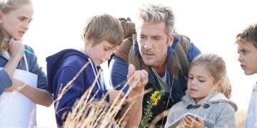


Physical and mental preparedness are both equally important. If you have the knowledge but can’t execute the skill, you won’t go far. The same is true of the opposite.
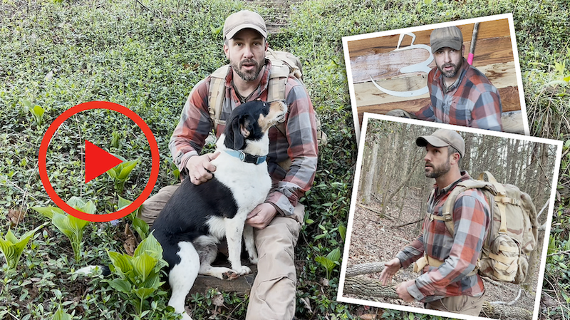
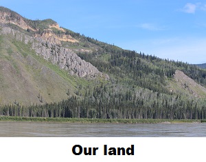
In this video, Jason Salyer explains one way that he stays in shape and sharpens his skills. By incorporating his land nav knowledge into a ruck workout, he can polish up his pace count application while getting in a good workout and performing a shakedown of his gear.
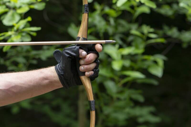
What’s a pace count, you ask? It’s the number of steps it takes you to cover a predetermined distance. Once you know your individual pace count, you can use that number to determine how far you’ve traveled. This is useful for plotted points during technical land navigation or for simply tracking your progress throughout a hike.
Jason’s example of working out and practicing your skills with your gear and clothing that you would have during an unexpected survival situation is a great way to see what works and what doesn’t work.
Also, if you need another reason to watch this informative video, his workout partner Maggie is very cute.


Your video had an encouraging effect on me. A year ago I decided to count my paces, but preferred to not do it on city sidewalks. By the time I got to a better place I didn’t have my Ranger Beads with me (and by the way two beads broke in half sitting in a night-dish (actually a short box…apparently they (plastic beads) were glued together and not drilled)–cheapo junk stuff that I had never used. Everything you demonstrated I have used in the past, but never at one location. I don’t walk trails for pleasure, I prefer exploring off-trail. Still knowing one’s pace in different terrains is valuable knowledge, and in my case when I am foraging, because then it helps me plot out a map/compass/paces-location where I might re-find a foraging location on a future trip. I totally forgot about the wheel-measure, most often used to lay-out sports fields. I felt greatly encouraged to practice map/compass/pacing work in a foraging context; and then to go back and determine if I can re-find a foraging site in a simple way (or not)–and all the while enjoying nature..
Jason, this is the second time I watched your video (from an email invitation). You did exactly what you intended to do (1) you got morning exercise carrying your pack; (2) you established your basic pace count; and you fulfilled your intentions.
Now, I am guessing that I am at least twice or 2.5 times your age, I want to count paces also, but not exactly the way you did. What I want to do is make a walking map of a reasonable amount of distance segments where I go off trail and find potential resources that would help me if I were hiking, camping, or migrating to a new far-away location and such as along your trail. So I want to find a dead standing “dry” tree that I could chop or saw down for firewood. I want to find water seeps (snow melt coming out of the side of the mountain-hill, or pocket-pools of water indicating by softer muddy-like ground. I want to identify every tree that has offers something edible (at some point of year). If I were to find any sort of dump site with metal, I want to note that on my “off trail pace counting trail map”, If in Spring or Summer I want to identify any edible plant, shrub that is “off trail”. If I were to find an area where I could dig-in or move some rocks for a cover-sleep area, or a cave or cliff overhang, I want to know where that is (such as in a tornado or lightning strike event. And lastly I want you to identify an “intentional hidey-hole location” say, such as if I injured myself so that I had to drop and hide or bury my bag, I would know where I could do that, then “crutch” my way to a “find help location”.
So you could pace your way up hill. Stop at a certain pace location, Go downhill any number of paces to explore the area. Write down your notes on what you find. If you can see your trail, you can walk parallel to it and count your paces, and put practice putting your “finds” on a map. Then some other day follow your map to see if you can refind what is on your first map; and do it again when the trees and shrubs start blooming.
Here is my point. Anyone can find a sleep spot off trail. But if you ever had to “lay low” for a period of time, you need fuel, water, safe spot from lightning (and maybe people)–all of that implies that your camp-sight would actually be possibly the whole side of your hill (and maybe every side of it–the whole mountain or hill top). You wouldn’t want to put your latrine uphill from your sleep spot. Lots of people in bear country say, Don’t eat nor cook in your tent. Counting paces if fine, but what is the point other than to count time related miles. Why not have fun out there and explore, then practice making a detailed map of resources off trail that you could use if you had to. That gives you practice map making at an extremely high level of detail. Just a thought. I will try to do this next Spring ( not in my snowy cold slippery winter weather). Maybe we can compare notes sometime when I get another email invitation to watch your pace-counting.
Do consider this. Among SurvPed readers, what would they most like to learn about, and especially if they are “out of shape”, haven’t been on a hike for 20-40 years, etc. Everybody likes an analagous treasure hunt for worthwhile stuff that may be nearby but outside of our awareness, or “just found”. Expand your pacing. Use your dog to help you, when he sniffs at something. Maybe it will be an animal hole that might provide trapping meat, if needed. Listen to the birds (in season). Are they following you spying on you? There is plenty to learn beyond pacing and that involves pacing when map making. Even surveilling the hill for best views, places you’d be seen by anyone, places best to light a smoke signal fire for someone to find you and help you. etc etc etc.
Here is what I want you to do. I want you to walk the direction of the same trail (and any time of year) and I want you to explore what is on –lets say the left side of your trail going up the mountain-hill and on the way down do the same thing. Find and note how many paces off trail where you find (1) A dead standing tree that appears to be dry and could be chopped down for good firewood. (2) Find swale that could give you water from snow melt or a heavy rain