


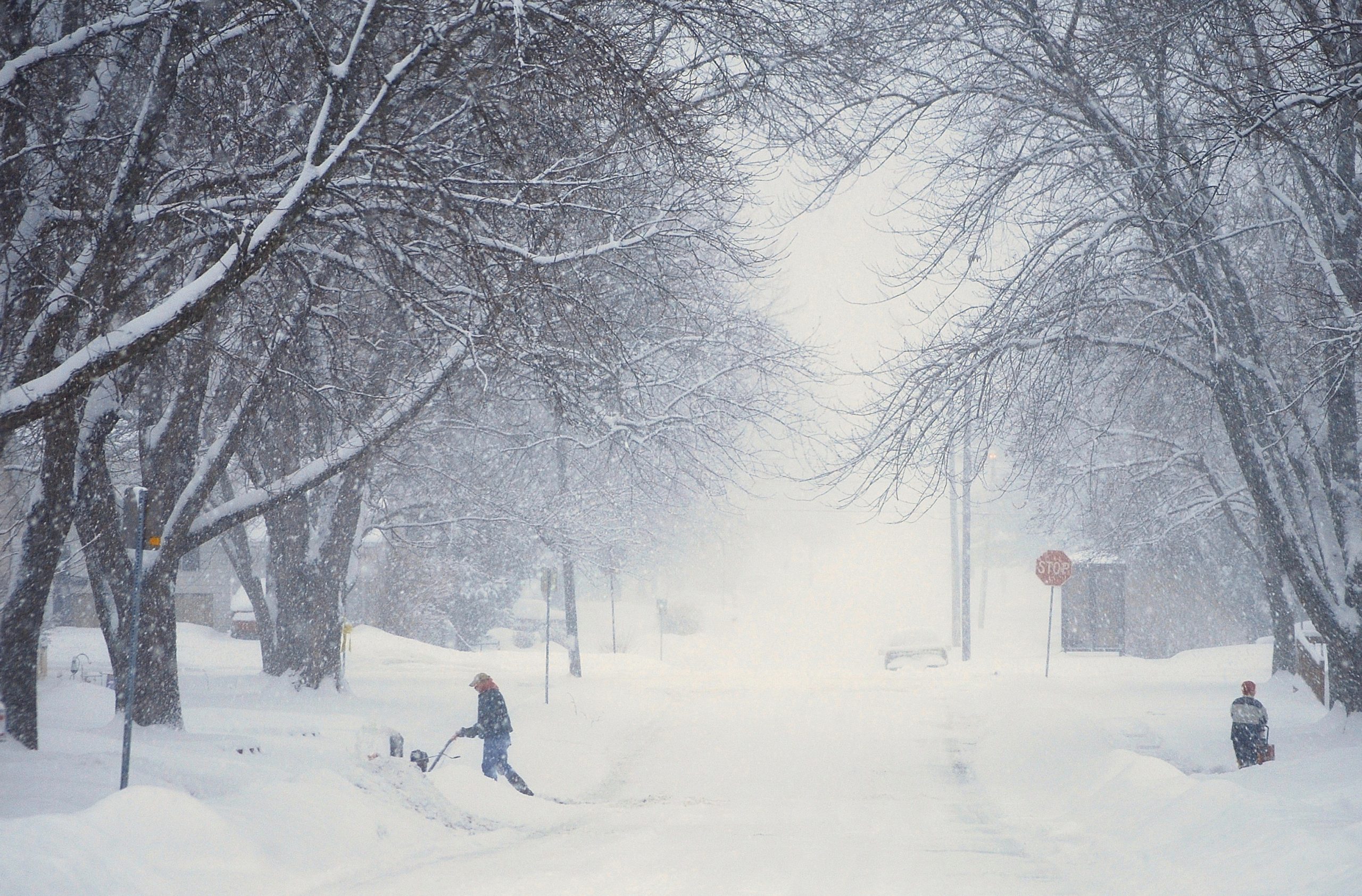
My grandfather could tell you what the weather would do three days out just by stepping onto his porch for five minutes. He’d look at the sky, watch the birds, sniff the air like some kind of human barometer, and make pronouncements that proved eerily accurate. I thought it was some kind of rural witchcraft until I realized he was simply reading signs that most of us have trained ourselves to ignore.

Most folks have become helplessly dependent on weather apps and the pull out their phones, check the radar, and plan accordingly. But what happens when you’re deep in the backcountry without cell service? Or when the grid goes down during the very storm you needed to prepare for? Suddenly, that ancient skill of reading weather becomes quite practical.
The atmosphere constantly broadcasts what it’s about to do. You just need to know what you’re looking at and perhaps, you won’t check your phone as often anymore.
The Sky Tells Everything: Reading Clouds
Clouds are the most reliable weather indicators available, and unlike apps, they never lose signal. Each cloud type corresponds to specific atmospheric conditions and tells you what’s coming.
Cirrus clouds are those wispy, feather-like streaks high in the sky, usually appearing white and delicate. They form at 20,000 feet or higher where temperatures are frigid and ice crystals create their characteristic appearance.
Here’s what matters: cirrus clouds often precede weather changes by 24 to 48 hours. They indicate moisture moving in at high altitude, typically ahead of a warm front. If you see cirrus clouds thickening and lowering over several hours, transitioning into a gray sheet that obscures the sun, weather is deteriorating. This progression, from wispy cirrus to overcast skies, often means rain within 24 hours.
Cirrocumulus clouds look like rippled sand or fish scales covering the sky. Old-timers call this a “mackerel sky,” and the traditional saying goes: “Mackerel sky, mackerel sky, never long wet, never long dry.” This pattern indicates instability at high altitudes and often precedes a weather change within 12 to 24 hours.
Altocumulus clouds are the mid-level puffy gray or white patches that often form in parallel bands or rounded masses. When you see these on a humid summer morning, there’s a decent chance of thunderstorms that afternoon. The atmosphere is showing you it’s unstable and loaded with moisture.
Altostratus clouds create a gray or blue-gray sheet covering the entire sky. The sun might be visible as a vague bright spot, but details are lost. This is your definite warning that precipitation is coming within several hours and it’s time to gather firewood and prepare a shelter.
Nimbostratus clouds are the dark, featureless gray blanket that brings steady rain or snow. Thery tell you to expect sustained precipitation, so when you see nimbostratus rolling in, you’re looking at hours of rain.
Cumulus clouds are the puffy, cotton-ball clouds of fair weather. Small, scattered cumulus with flat bases and rounded tops mean stable conditions. But watch them carefully and if those friendly puffs start building vertically, growing taller throughout the day, the atmosphere is becoming unstable.
Cumulonimbus clouds are the monsters, towering thunderheads that can reach 50,000 feet high. These are your severe weather makers: heavy rain, lightning, hail, possibly tornadoes. A cumulonimbus has a distinctive anvil-shaped top where the cloud hits the stratosphere and spreads out. If you see one forming, especially if the base appears dark and the cloud shows strong vertical development, take shelter immediately.
Stratus clouds are low, gray, uniform layers that create overcast skies and often bring drizzle or light rain. They’re not dramatic, but they signal stable, poor weather that can persist for days.
The direction clouds move matters too and in most of North America, weather generally moves west to east. Clouds moving from the south or southeast often bring moisture and warmth. Clouds from the north or northwest typically bring cooler, drier conditions, or in winter, serious cold and snow.
Pressure Changes: Your Body as a Barometer
Atmospheric pressure drops before storms arrive and rises as weather improves. You don’t need instruments to detect this because your body and the world around you respond to pressure changes in predictable ways.
As pressure drops, many people experience headaches, joint pain, or sinus pressure. If your bad knee that “always knows when it’s going to rain” starts aching, there’s actual science behind it. Decreased atmospheric pressure allows tissues to expand slightly, which can irritate nerve endings in joints and sinuses.
Sound travels differently too and low pressure means sound carries farther and clearer. If distant sounds like train horns, highway noise and neighbor’s dogs, seem unusually loud and clear, pressure is likely dropping and weather is moving in.
Smoke behavior changes with pressure and when pressure is high (fair weather), smoke rises straight up. When pressure drops, smoke hangs low or drifts horizontally. If your campfire smoke won’t rise but instead hangs around camp, weather is changing.
Smells intensify before storms and dropping pressure releases gases and compounds from soil, plants, and other sources that normally remain trapped. That earthy smell before rain is called petrichor and comes partly from oils plants release during dry periods, which are then stirred up as pressure drops and wind picks up.
Animal Behavior: Nature’s Weather Service
Animals respond to atmospheric changes we barely notice. They’re better at detecting pressure shifts, humidity changes, and electromagnetic fluctuations that precede weather events.
Birds are excellent indicators and when pressure drops, it becomes harder for birds to fly at high altitudes. You’ll see them flying lower than usual before storms. Birds also feed more actively before bad weather, instinctively stocking up before conditions make hunting difficult. If you see birds feeding frantically or congregating in large numbers, weather is likely changing within hours.
Swallows and bats normally hunt insects at higher altitudes, but before storms, they swoop low to the ground. That’s because their prey (flying insects) also struggles in low pressure and descend to lower altitudes.
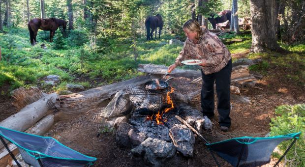
Cows and horses tend to lie down before rain and there are competing theories about why they do so. Some say they’re trying to keep a dry spot while others suggest they’re uncomfortable with pressure changes. Either way, it’s a consistent pattern.
Insects change behavior dramatically and ants work frantically before rain, often relocating their nests to higher ground. Spiders abandon webs before storms because those webs would be destroyed anyway, so they hunker down. If you see spiders taking down their webs in the afternoon, expect weather that night.
Bees return to hives earlier than usual before storms. They’re extremely sensitive to pressure and humidity changes.
Frogs and toads croak more before rain. Humidity rises before precipitation, which these amphibians find favorable for activity and breeding.
Even domestic animals react and your dogs and cats often become restless or seek shelter before storms. If your normally outdoor-loving dog suddenly refuses to leave the porch, pay attention.
Wind Patterns and Temperature Shifts
Wind direction tells you what’s coming. Here’s a general guide for mid-latitudes in North America:
East or northeast winds often precede storms. There’s an old saying: “When the wind is in the east, ’tis neither good for man nor beast.” Storms typically approach from the west, and as they get closer, circulation patterns pull wind from the east.
South or southeast winds bring moisture and warmth, often preceding rain.
West or northwest winds typically bring clearing conditions, drier air, and often cooler temperatures after a storm passes.
North winds bring cold air, clear skies, and in winter, potential for snow if moisture is available.
Sudden wind direction shifts indicate frontal passages and a shift from south to west or northwest often means a cold front just passed and weather is improving. A shift from west to east might mean deteriorating conditions.
Temperature changes matter too. Rapid temperature drops suggest a cold front approaching. If it’s 75°F at noon and suddenly drops to 65°F in an hour, weather is changing fast.
Conversely, unusually warm, humid conditions, especially if they feel oppressive and still, often precede severe weather. That heavy, sticky air before a summer thunderstorm is warm, moist air mass loaded with energy.
Folk Wisdom That Actually Works
Many traditional weather sayings contain genuine meteorological truth:
“Red sky at night, sailor’s delight. Red sky at morning, sailor take warning.” This one’s legitimate. Sunlight scattering through dust particles in dry air creates red sunsets. High-pressure systems (fair weather) typically bring dry air, and since weather moves west to east, clear skies to the west mean good weather approaching. A red sunrise, however, means clear skies to the east (where weather came from) and potentially stormy skies approaching from the west.
“Ring around the moon, rain real soon.” Halos around the moon or sun are caused by ice crystals in cirrostratus clouds, those high, thin clouds that precede warm fronts and precipitation. This often does indicate rain within 24 hours.
“If the leaves show their undersides, be very sure that rain betides.” Wind ahead of storms often flips leaves upside down. Many trees have lighter-colored leaf undersides, making this visible from a distance.
“When dew is on the grass, rain will never come to pass.” Dew forms on clear, calm nights when ground cools through radiation. These conditions suggest high pressure and stable air which leads to fair weather. No dew often means clouds or wind prevented cooling, suggesting unsettled conditions.
Putting It All Together
Weather prediction without tools isn’t about relying on any single sign. It’s about observing multiple indicators and recognizing patterns.
Here’s an example scenario: You wake up to see wispy cirrus clouds in the western sky. By mid-morning, they’ve thickened into a gray sheet. The air feels heavy and sounds seem unusually clear. Birds are feeding frantically. Your campfire smoke won’t rise. By afternoon, you notice the wind has shifted to the southeast.
Each sign individually might not mean much, but together, they’re screaming that rain is coming within hours, so it’s time to prepare.
Conversely: The morning starts overcast with low stratus clouds. By noon, breaks appear in the clouds. Wind shifts from east to northwest and the smoke from your fire rises straight up. Temperature drops five degrees and the birds are flying high again. The improvement is obvious and it means that the weather is clearing.

Practice Makes Perfect
Start paying attention to the signs around you, when you can verify your observations against forecasts. Note what clouds appear and what weather follows and watch how animals behave before storms. Feel the air quality change and over time, these observations become instinctive.
Keep a simple weather journal and each day, note cloud types, wind direction, animal behavior, and anything unusual. Then record what weather actually occurred and you will notice that patterns emerge quickly.
This skill on which our ancestors relied on isn’t lost and many folks living in rural areas still rely on it. For the rest of people, it’s just sleeping, waiting for us to pay attention again. Your phone might die, but the sky always has something to say and you just need to learn its language.
There’s something deeply satisfying about looking at the sky and knowing what’s coming, not because an algorithm told you, but because you can read the story the atmosphere is writing across the clouds.
Others Are Watching Now:


