


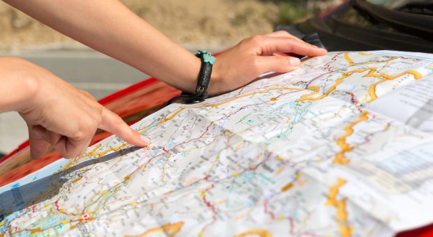
Most of us are used to using road maps, but there are a lot of people who have never had to deal with a topographic map.
Yet, in a survival situation, topographic maps are much more likely to be useful, especially if we find ourselves needing to go off-road in order to avoid the dangers of being around other people.
The basic difference between the two is that road maps focus on man-made structure, specifically roads, with only limited presentation of natural features, such as rivers and lakes. Topographic maps will mostly focus on natural land features, even though they will show man-made structures, roads and bridges. However, those man-made structures may not be clearly identified, as they would in a road map.
Topographic maps give you a lot of information about the land which they cover, most specifically, the land contours. But they will also show bodies of water, vegetation and water. Once you understand the information provided, you will be easily able to covert what you see on the map into physical features in the land, “seeing” the land as it pops up from the paper map before you.
Never rely on your memory when traveling in wilderness areas, unless you are on marked trails. Rather, always be sure to have a topographic map and compass with you, so that you can be sure of where you are and where you are going.

It is useful to have any topographic map laminated, if it doesn’t already come that way, so that you can mark on it with grease pencils or water-based markers, and then erase it again.
Understanding the Key
A key part of understanding any topographic map is understanding the colors. The standard color code is:
- Black for man-made objects
- Brown for contour lines
- Blue for water
- Green for vegetation, specifically woods
- Red for political features, such as state lines
- Purple for new changes in the latest version of the map
At times there will be combinations of these colors. A marsh, for example, may be shown as a green area with blue lines, like springs of grass, or a blue area with green sprigs of grass, depending on the type of marsh. Glaciers might be shown in a combination of blue and brown, especially where they are showing areas of the glacier’s advance or retreat.
Some areas are shaded, such as lakes and ponds, which are shaded in blue. Dry areas, without vegetation will usually be shown in brown, whether that is due to it being a desert or being mine tailings. Sand will be shown as speckled brown.
Contour Lines
One of the most important part of any topographic map is the contour lines. These give you the ability to “see” how the land is formed, by providing you with a drawing of the rises and falls of the land. The maps do this through a series of brown lines, which indicate the elevation above sea level. Since each line is drawn on a particular elevation above sea level, with a little practice you’ll be able to see how the land is shaped. There are three different types of contour lines:
- Major contour lines – These are bolder, more visible lines, with the elevation noted periodically in the line
- Contour lines – Thin, light brown lines which indicate 10 feet of vertical elevation; they are provided to break up the space between the major contour lines, further identifying the shape of the land
- Supplemental contour lines – In relatively flat areas, where the contour lines may be far apart, these supplemental lines are added, dividing the elevation between contour lines in half. They are indicated by a dashed light brown line
You can quickly tell from these lines how steep the ground is. The closer the lines are together, the steeper the terrain. Anyplace were adjacent lines converge indicates a cliff face. Areas where the lines are far apart indicate relatively flat land. Hilltops or mountaintop can readily be found, as they will have a circle or oval, with a number (indicating the altitude) inside it and concentric rings around it. Valleys become apparent because they are between the hills.
With just a little practice, you can readily identify the various terrain features and the contour of the ground, just from looking at the brown contour lines on the map. This is easier to do when taking in a wide swath of land, rather than just looking at a single terrain feature. Seeing and identifying a number of different mountain peaks or a mountain peak and a lake, give you a better indication of your position, than just sighting in on one peak or one lake.
Locating Yourself with a Topographic Map by Resection
You can precisely locate your position with a topographic map and a compass. For this, you’ll need a compass which provides declination marks for the various degrees around the compass face, not just compass points. While there are many types of compasses which do this, I find it easiest to work with a military Lensatic compass, because it provides an easy way to sight along an azimuth and get a reading.
To do this, you need to sight the azimuth to at least two different terrain features. Ideally, those should be roughly 90 degrees apart. The closer they are together, the less accurate your location will be. On the other hand, if you pick locations that are close to 180 degrees apart, you will have the same problem.
Take the azimuths and determine their reverse azimuths. To do this, for any azimuth that is less than 180 degrees, add 180 to it. For any azimuth that is over 180 degrees, subtract 180 from it. Then, using a protractor and straight edge, draw a line on your map, from the terrain features along that azimuth. Where the lines cross is where you are.
Locating Grid Coordinates
Once you have located yourself on the map, you can readily turn that into grid coordinates, so that you can transmit that information to others. This can be expressed in either geographic coordinates (longitude and latitude) or UTM grid coordinates (easting and northing). Both systems work essentially the same, although they are expressed differently. Your map may have one or the other, or both on it.
These coordinates are noted on the edges of the map, with lines running across the map, creating a grid. You will need two sets of numbers, one on the horizontal and the other on the vertical to provide coordinates to your location. Normally, the east-west coordinate is provided first, followed by the north-south coordinate. This order can be remembered by the phrase, “In the house, then up the stairs.”
It is possible that your map may have the coordinates marked on the edge of the map, without the gridlines drawn in. Should that be the case, you’ll need to draw in the lines by hand, using a straight edge and a pencil. However, most maps have the gridlines drawn in, albeit lightly.
This Timeless Collection of Forgotten Wisdom Will Help You Survive!
Once you have located your position by resection (as discussed above), you can see what grid lines you are closest to, providing yourself with grid coordinates. However, this is not a detailed grid coordinate. In order to get a detailed grid coordinate, you’ll need to use a UTM Corner Ruler or UTM Grid, as shown below. There are several styles of these, available online.
This corner ruler is printed on transparent plastic, allowing you to overlay it on the map and get an accurate grid coordinate. If you look at the 1:24,000 scale, you can see that it shows you marks for up to 1 km of distance. That is broken down in tenths, with tic marks for hundredths. So, you can identify a grid location down to 10 meters. The perimeter of the corner rule provides a protractor, so that you can do your resection.
Finding a Given Grid Reference
If someone gives you a grid reference, you can work in reverse to locate them. Starting with the first two numbers in the horizontal and vertical (or north-south and east-west) coordinates, locate the appropriate grid square. Then use the corner rule to pinpoint their location more accurately.
Locating Yourself with a Topographic Map and a GPS
If you have a GPS available to you, it should be able to provide you with either geographic coordinates in degrees, minutes and seconds or UTM grid coordinates in meters. You can use that information to locate yourself on the map, just as you would use the map to locate someone who had transmitted grid coordinates to you.
Navigating with a Topographic Map
Once you understand how a topographic map provides you with a picture of the terrain, it is fairly easy to plot a course and follow it. Starting from where you are, determine where you want to go. Then look for terrain that avoids obstacles, like swamps and lakes, while providing easy traveling. This may be along a valley or higher up on a hillside, just below the crest.
Mark out your route on the map for reference. Using the map’s scale, covert each leg of the route into distance, and find the direction of travel for each leg as well. This will provide you with the basic information you need, to get from where you are, to where you want to go. It is also useful to locate landmarks on the map, which will tell you when you reach the point where you want to change directions to a new bearing.
Your compass will point to magnetic north. This may or may not be the same as true north and it may or not be the same as grid north on the map. You actually have three different “norths” to concern yourself with:
- Magnetic north – the direction your compass points to
- Grid north – north as the map is drawn
- True north – the direction to the north pole
True north isn’t actually important when using a compass, but it is when using a GPS. For the purpose of a compass, you need to know the difference between grid north and magnetic north. This will be noted in a small diagram at the bottom of the map. You will either need to add or subtract a few degrees to the azimuth you get from the map, so that as you follow your compass, you will be going the direction you plotted out on the map.
With this determined, use the compass to sight along your line of travel, picking out distant landmarks that you can walk towards, to ensure that you are walking in the right direction. Then you can put away your compass and map and start walking.
There are two ways of determining when you need to turn, according to the route you plotted out on the map:
- Using landmarks to show when you have arrived at that point
- Counting steps – this requires knowing how many steps you walk per 100 meters, for that type of terrain
Either way, you can determine when you have walked far enough in that direction and it is time to turn. Once at that location, take your compass back out and pick out landmarks along your new direction to aim for. In this way, you can walk a rather complex route, if necessary to avoid terrain features or people, and still get to your intended destination.


URL for topo map key is: “https://pubs.usgs.gov/gip/TopographicMapSymbols/topomapsymbols.pdf”.
Bill, I Do Not know how many readers will even Try to understand the immense value of what you are teaching them in this Article. But, I do. I have been using these USGS mapping features for decades. Well, Sir, you Tried.
Of all the Life’s skills with effort one can acquire.. Land Navigation is one of those that really is a blessing . If you love the outdoors it is hard to describe the enjoyment you will find in conducting a Map Reconnaissances (many) of an area you wish you explore before going there. When I used to hunt dangerous game.. When I went Prospecting.. I would pour over maps of the terrain until I knew the area of operation in my head.. You can spend many an evening in that enjoyable pursuit sitting in your easy chair by the fire, pipe, rum.. Hard to beat..
Recognizing terrain features. knowing with certainty where you are . Where you have been where you are going is tremendously fulfilling , It can also be a source of modest pride.. My adult children and I went on an extended hiking trip into the mountains.. As we were returning I wanted to reduce the distance by leaving the trails and pre-planned route..The crew waited patiently while I sat with my Map, Compass, Protractor.and performed some calculations..After checking my calculations and writing down my alternate route.. We set out cross country.. After 3 hours moving thru Deep Forrest) I said.. “well we ought to be there” right about where we left our vehicle (Hidden in a small Arroyo)… We stepped around some large Shrubbs… and there below us 30″ away.. was our Vehicle.. No one said anything (least of all me). I tried very hard not to smile. but I could see by glances and the rolling of eyes., “That old man” .. LOL
All the best… Land Navigators and many many years from now may you all merit a place in “Map Heaven”
A Truly Beautiful Christmas Story, Vic. I Loved it. God’s Rich Blessings to you and yours.
How goes it, ‘old man’? 🙂 I’m in my 60s, and long ago lost count of the times the kids or grandchildren, nieces and nephews asked advise and then did something else… And, then, a buck for each time they came and admitted I was right. Bro, I could boot soros out of top place for world’s wealthiest. But, wisdom comes of experience and they got theirs the hard way, by not using my mistakes to keep from their own. Much thnaks for the word, niio!
Bill, The link specified for the USGS Website has a misspelling (the word “topographical” in the map symbol reference has the “a” and the “p” transposed.)
Otherwise, a nice intro to the topic. Thanks,
I just got the chance to hold and glance for a short time a topographical map and it’s quite complicated. But now I’m learning and got new ideas too.
I’ve been using Topo Maps for over 50 Yrs. and have a collection of more than 100 From various places I have traveled to adventure. Otherwise an excellent introduction to Land Navigation and Topographic Maps. Thanks for writing.
I saw no reference to the initial requirement of using a Topographic map for resection location. Orientation of the map. We also have the problem of the shifting of Magmetic North Pole and it’s effect on Declination. Otherwise a great intro to Land Navigation. Like others here I have been using and collection Topo Maps for 5o or so years. Many Adventures later I still love and refer to them any time I head off trail or road.
Where to get these maps?
Thanks,
Hawk
In the province of Ontario, in Canada, we buy them in hunting/fishing supply shops located in the area that we are interested in exploring. When i had a cottage up north , east of Parry Sound, i got mine in the local baitshop. I think it was $5 or maybe $7.50 & then i took it to STAPLES or BUSINESS DEPOT to get it laminated in plastic. That cost just over $17
I got a really good engineers compass for about $10 & then got a backup for a few $ at a store that sold satellite dishes, coax cable, & other cable tv supplies. I think it was $2, it had a plexiglas holder.
Thanks,
Hawk
I got mine laminated so that it wud look real good after i nailed it to the wall of the cottage.
We learned to read topographical maps in highschool, GEOGRAPHY class, grade 11. When i ran into Mr. Hale at my highschool reunion when i was 50 I thanked him for teaching me that skill. When i was about 47 i had to change careers rather than move my whole family eastward 5 hours. I became a radio inspector, that is a federal officer, an expert in radio communications systems. In my class of about 22 officers i was the only one who already knew how to read topo maps.
In grade 11 i was 16, and the map he used as anexample covered the area around the city of guelph & town of acton,northwest of toronto. Then when i was in university at 23 my parents moved to guelph but i stayed in toronto. They were amazed at how well i knew the countryside there, & all itsglacial features. Then when i was 47 i had to attend radio inspector classes in acton where my federal department had their radio spectrum observation centre and its located on land at the same high elevation as the top antennas of the CN TOWER in Toronto. From that radio observationcentre wecould tine in to listen to almost any radio system located in the city of toronto, & listen to it.